
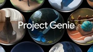
Project Genie turns Street View into interactive worlds: are Google Maps becoming game-like?
Project Genie with Street View sounds like a science-fiction version of maps: choose a real place, apply an imaginative style, describe a character, and explore a generated interactive world anchored in Street View imagery. The obvious question is whether Google Maps is becoming a game. The more accurate answer is narrower and more interesting: Google Labs is testing a world-model prototype that uses real-world imagery as a starting point for interactive environments.
Google announced the new Project Genie Street View capability on May 19, 2026. Genie is described by Google DeepMind as a general-purpose world model capable of generating diverse, interactive environments. Google says Genie has been used as a research tool for agents learning and reasoning in complex virtual settings and for Waymo road-environment simulations. The new feature connects Genie with nearly 20 years of Google Street View imagery, allowing users to create worlds anchored in reality.
The user flow is playful. A user taps the Maps pin, chooses a place in the United States, optionally selects a style such as Desert Sands, Stone Age, Ocean World, or B&W film, and then describes a character. Genie uses that information to create an imaginative world whose starting location is tied to Street View real-world imagery. Google gives examples such as the Golden Gate Bridge under the sea with Ocean World style and the Fort Worth Stockyards in Texas in a 1920s-style B&W film look.
The feature is powered by Maps Imagery Grounding, which Google says developers use to create AI visuals with Street View. Availability is limited. Street View imagery in Project Genie is available now for places in the U.S., with plans to expand over time. Project Genie, including the Street View capability, is gradually rolling out starting May 19, 2026 to all eligible Google AI Ultra USD 200 subscribers globally, age 18 and older. It is an experimental research prototype in Google Labs, and Google says it is working to make details sharper and more accurate.
That combination makes Project Genie fascinating, but it also requires careful wording. It is not accurate to say Google Maps has become a game. It is more precise to say Project Genie is a Google Labs experiment that uses Street View grounding to turn selected real places into imaginative, interactive worlds. For related Google visual and spatial AI context, see Google smart glasses are back: will they succeed after Google Glass failed?, Gemini Spark: an assistant that works 24 hours even while you sleep, and Ask YouTube instead of watching the whole video: Google changes how we consume content.
What is Project Genie?
Genie is Google DeepMind's general-purpose world model for generating interactive environments. A world model is not just an image generator. It is designed to represent environments that can respond to actions. In practical terms, Genie can create a world a user or agent can move through, rather than a single static picture.
Google has presented Genie as a research tool for agents learning and reasoning in complex virtual settings. It has also been used for Waymo road-environment simulations, according to the official announcement. That research background matters because it shows why interactive worlds are not only entertainment. They can help AI systems learn about space, movement, cause and effect, and changing environments.
Project Genie is the Google Labs prototype that lets users experience this technology more directly. The new Street View connection makes the prototype easier to understand because it starts from recognizable places. Instead of generating an imaginary world from nothing, Genie can use real-world imagery as an anchor.
That anchor does not mean the generated environment is a perfect replica. Google says the feature creates imaginative worlds based on real places, and it is working to make details sharper and more accurate. Users should expect experimentation, not survey-grade precision.
How Street View changes the experience
Street View is one of Google's richest visual datasets. It represents nearly 20 years of imagery across roads, landmarks, neighborhoods, and public spaces. Connecting a world model to Street View changes the emotional feel of generation. A fantasy world based on a random prompt is interesting. A fantasy world based on a place you recognize is more personal.
Google's examples show the range. The Golden Gate Bridge can be reimagined under the sea using Ocean World style. The Fort Worth Stockyards can become a 1920s-style black-and-white environment. The result is not traditional navigation. It is creative exploration grounded in a real starting point.
The official user flow is simple. Tap the Maps pin. Choose a place in the U.S. Select an optional style, such as Desert Sands, Stone Age, Ocean World, or B&W film. Describe a character. Genie then creates an imaginative world whose starting location is tied to Street View imagery.
Maps Imagery Grounding is the technical bridge. Google says developers use it to create AI visuals with Street View. In Project Genie, that grounding helps the generated world remain connected to real-world imagery, even as the style and characters become imaginative.
For students and educators, that makes the feature more than a toy. A geography class could compare a real U.S. landmark with a stylized version. A history teacher could use a 1920s visual style to start a discussion about how cities change. A design student could explore how visual atmosphere affects perception of place. Truescho's global education audience often uses resources such as official link and official link; Project Genie sits in a different category, but it points to how AI may reshape learning environments.
Is Google Maps becoming a game?
The cautious answer is no, not as an official product claim. Project Genie is not being announced as a full Google Maps game. It is an experimental research prototype in Google Labs that uses Street View grounding. The experience may feel game-like because it creates interactive worlds, includes characters, and lets users explore stylized places. But game-like is not the same as a finished game product.
That distinction matters. Google Maps is a navigation and location platform. Project Genie is a Labs experiment using map imagery. The two are connected through Street View and Maps Imagery Grounding, but that does not mean the core Maps app is turning into a game for everyone.
The best framing is that Google is exploring how real-world imagery can become interactive, generative environments. That has implications for games, virtual tourism, education, AI agent training, robotics research, urban imagination, and creative prototyping. But it should not be described as a professional simulator or an accurate planning tool for safety-critical decisions.
Project Genie compared with Google Maps and traditional games
| Category | Google Maps / Street View | Traditional video game world | Project Genie with Street View |
|---|---|---|---|
| Main purpose | Navigation, place discovery, real-world orientation | Entertainment, challenge, story, simulation | Experimental interactive world generation |
| Source material | Real geographic data and imagery | Designed assets, engines, levels, rules | Real Street View imagery plus generative world modeling |
| User action | Look around, navigate, search places | Move, interact, complete objectives | Choose U.S. place, style, character, then explore generated world |
| Accuracy expectation | High for navigation context, though not perfect | Depends on game design | Experimental; Google is improving sharpness and accuracy |
| Availability | Broadly available depending on Maps coverage | Depends on game/platform | Eligible Google AI Ultra USD 200 subscribers globally, 18+, gradual rollout; U.S. Street View places now |
| Best use | Directions, local search, trip planning | Play, storytelling, training, simulation | Creative exploration, education, research curiosity |
| Risk of misunderstanding | Outdated imagery or route mistakes | Fictional rules mistaken for realism | Generated details mistaken for real-world accuracy |
The comparison shows why the phrase "game-like maps" is tempting but incomplete. Project Genie borrows some emotional qualities from games: exploration, visual transformation, character-driven worlds. But it is not built around confirmed game mechanics, competition, quests, scoring, or public multiplayer systems.
It is better understood as a bridge between mapping, generative media, and interactive simulation.
A realistic example: Olivia explores San Francisco for a design class
Olivia is a 22-year-old design student in Melbourne taking a course on urban storytelling. Her assignment is to create a five-minute presentation showing how visual style changes the way people perceive a landmark. She chooses the Golden Gate Bridge because it is recognizable and has strong visual identity.
Without Project Genie, Olivia might collect 20 reference images, watch 3 travel videos, and build a mood board in 90 minutes. With Project Genie access, she could choose a U.S. Street View place near the bridge, select Ocean World style, describe a marine explorer character, and generate an interactive world that begins from the real location.
Her numbers are concrete. She spends 12 minutes generating the world, 18 minutes exploring and capturing observations, and 30 minutes comparing the result with standard Street View and historical photos. In one hour, she has a richer classroom discussion: what remains recognizable, what changes emotionally, and where the AI world becomes less accurate.
The last point is important. Olivia should not claim the generated environment is a real underwater simulation of San Francisco. She should describe it as an imaginative AI environment grounded in Street View imagery. That wording keeps the creative value while respecting the experimental limits.
For learners comparing visual AI experiences, Google's smart glasses work at Google smart glasses are back: will they succeed after Google Glass failed? offers a different angle: AI overlaid onto what a person sees. Project Genie is different. It creates an interactive environment from imagery rather than adding assistance to a live view.
Who can access Project Genie Street View?
Google's availability statement has several parts. Project Genie, including Street View capability, is gradually rolling out starting May 19, 2026 to all eligible Google AI Ultra USD 200 subscribers globally, age 18 and older. Street View imagery in Project Genie is available now for places in the U.S., with plans to expand over time.
That means two things can be true at once. Eligible subscribers may be global, but the Street View place selection is U.S.-based for now. Writers and readers should not simplify that into "available everywhere" or "only for U.S. users." The user eligibility and place availability are different dimensions.
It also means Project Genie should not be confused with cheaper Gemini Advanced access. Truescho's shop at Truescho shop may be useful for everyday Gemini Advanced access, but the official information does not say Project Genie or Google AI Ultra USD 200 access is included through that offer. For subscription context, see Google AI Ultra at $100: why Google wants AI to become a premium subscription.
Age eligibility matters too. Google states eligible subscribers must be 18 or older. That affects schools, younger students, and family accounts. Educators should wait for official education or classroom guidance before treating Project Genie as a general student tool.
Educational and creative uses
Project Genie could be useful in geography, history, urban studies, design, media, and creative writing. A teacher might ask students to compare real Street View imagery with a generated Stone Age or B&W film version of a place, then identify which elements are real, stylized, or invented. A design class might study how color, texture, and character design change spatial perception.
Virtual travel is another obvious use. People who cannot visit a U.S. landmark could explore an imaginative version of it. That is not the same as accurate travel research, but it can spark curiosity. A student researching universities might use Truescho's rankings at official link for factual comparison, then use tools like Project Genie for creative exploration of places and visual culture, when available.
Creative prototyping may be the strongest near-term use. Game designers, filmmakers, architects, and storytellers often need quick mood explorations before building detailed assets. Project Genie could help them test how a real location feels under different visual styles. Again, the generated result should be treated as inspiration, not as an accurate model for engineering or planning.
AI research is also relevant. Google says Genie has been used for agents learning and reasoning in complex virtual settings. Interactive environments can help researchers test how agents understand space, movement, and consequences. Street View grounding adds real-world structure to those experiments.
Limitations and risks
Google says Project Genie is experimental and that it is working to make details sharper and more accurate. That is a clear warning. Generated worlds can be visually impressive while still making mistakes. A building facade may look plausible but wrong. A street layout may feel familiar but not match reality. A historical style may create atmosphere without accurate historical detail.
Users should not use Project Genie for safety-critical planning. It should not replace professional mapping, architecture, emergency planning, road simulation, accessibility audits, or real-world navigation. It can inspire ideas and support learning, but it should not be treated as ground truth.
There is also a perception risk. When AI grounds output in real imagery, users may trust it more than they should. A fully imaginary fantasy scene is easy to label as fiction. A generated world starting from a real landmark can feel authoritative. Clear labeling, cautious interpretation, and source comparison are essential.
The availability limits are also practical. U.S. Street View places are supported now, with expansion planned over time. Access is tied to eligible Google AI Ultra USD 200 subscribers globally, age 18 and older, through a gradual rollout. Many users will not have immediate access.
What to watch next
The most important future signal will be expansion beyond U.S. Street View places. If Google extends coverage to more countries, the educational and cultural possibilities become much broader. Another signal is detail quality. Google already says it is working to make details sharper and more accurate, so improvements in stability, visual consistency, and place fidelity will matter.
Developer access through Maps Imagery Grounding is another area to watch. If more developers can responsibly create AI visuals grounded in Street View, the ecosystem may expand beyond a single Labs prototype. That could lead to museum experiences, travel previews, classroom tools, creative studios, or accessibility-oriented previews, depending on policy and implementation.
Finally, watch how Google separates playful exploration from factual mapping. The clearer that boundary remains, the more useful Project Genie can be. Users need to know when they are navigating the real world and when they are exploring an imaginative AI world based on real imagery.
FAQ
What is Project Genie?
Project Genie is a Google Labs experimental prototype based on Genie, Google DeepMind's general-purpose world model for generating interactive environments. The Street View capability lets users create imaginative worlds anchored in real-world Street View imagery, starting from selected places in the United States.
How does Project Genie use Street View?
Google says Project Genie connects Genie with nearly 20 years of Street View imagery. Users choose a U.S. place, optionally select a style, describe a character, and generate an interactive world whose starting location is tied to real-world Street View imagery.
Is Project Genie part of Google Maps?
Project Genie uses Street View and Maps Imagery Grounding, but it should not be described as Google Maps becoming a full game. It is an experimental Google Labs prototype that uses map imagery as grounding for generated interactive worlds, not a general Maps replacement.
Where is Project Genie Street View available?
Street View imagery in Project Genie is available now for places in the U.S., with plans to expand over time. Project Genie is gradually rolling out to eligible Google AI Ultra USD 200 subscribers globally, age 18 and older, starting May 19, 2026.
Is Project Genie a game?
It may feel game-like because users can explore generated interactive worlds, choose styles, and describe characters. However, Google describes it as an experimental research prototype in Google Labs. It is not announced as a full Google Maps game with standard game mechanics.
How accurate are Project Genie worlds?
Google says it is working to make details sharper and more accurate, which means limitations remain. The generated worlds are imaginative environments grounded in Street View imagery. They should not be treated as precise replicas, professional simulations, or reliable tools for safety-critical planning.
Can students use Project Genie for learning?
Potentially, where access is available and age requirements are met. It could support geography, design, history, media, and creative writing activities. Students should still separate imaginative AI output from factual research and verify real-world information through official sources.